
 https://doi.org/10.4081/peasa.86
Insight to Late Antique structures of Karia Trakheia in the Diocese of Asia and their distribution patterning across the landscape
HTML: 0
All claims expressed in this article are solely those of the authors and do not necessarily represent those of their affiliated organizations, or those of the publisher, the editors and the reviewers. Any product that may be evaluated in this article or claim that may be made by its manufacturer is not guaranteed or endorsed by the publisher.
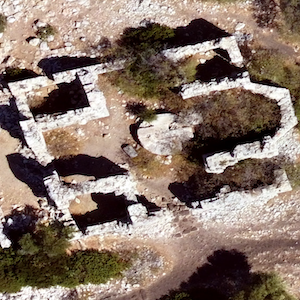
This paper explores the Bozburun Peninsula within its Late Antique context and examines the spatial extent of apsidal structures through the Early-Middle Byzantine period. Drawing on surveys conducted across the territorial and insular sectors (ca. 460 km2), remote sensing (primarily aerial and Lidar technology), and earlier records merged to increase the reliability of data interpretation, the results indicate a densification of religious buildings toward the centre of the region (and slightly austral), particularly in the vicinity of Tymnos and Thyssanos, whereas no clear correlation with scale emerges in either the southern or northern sector. Given these results, the positioning of apsidal structures in Karia Trakheia suggests a network-based organization centered on an omphalos-like domain, with structures clustering in certain places as if radiating outward from a navel — that is, densely clustered around a central node, in the way spokes radiate from a hub.




How to Cite

This work is licensed under a Creative Commons Attribution-NonCommercial 4.0 International License.
Copyright (c) 2026 The Author(s)
PAGEPress has chosen to apply the Creative Commons Attribution NonCommercial 4.0 International License (CC BY-NC 4.0) to all manuscripts to be published.